
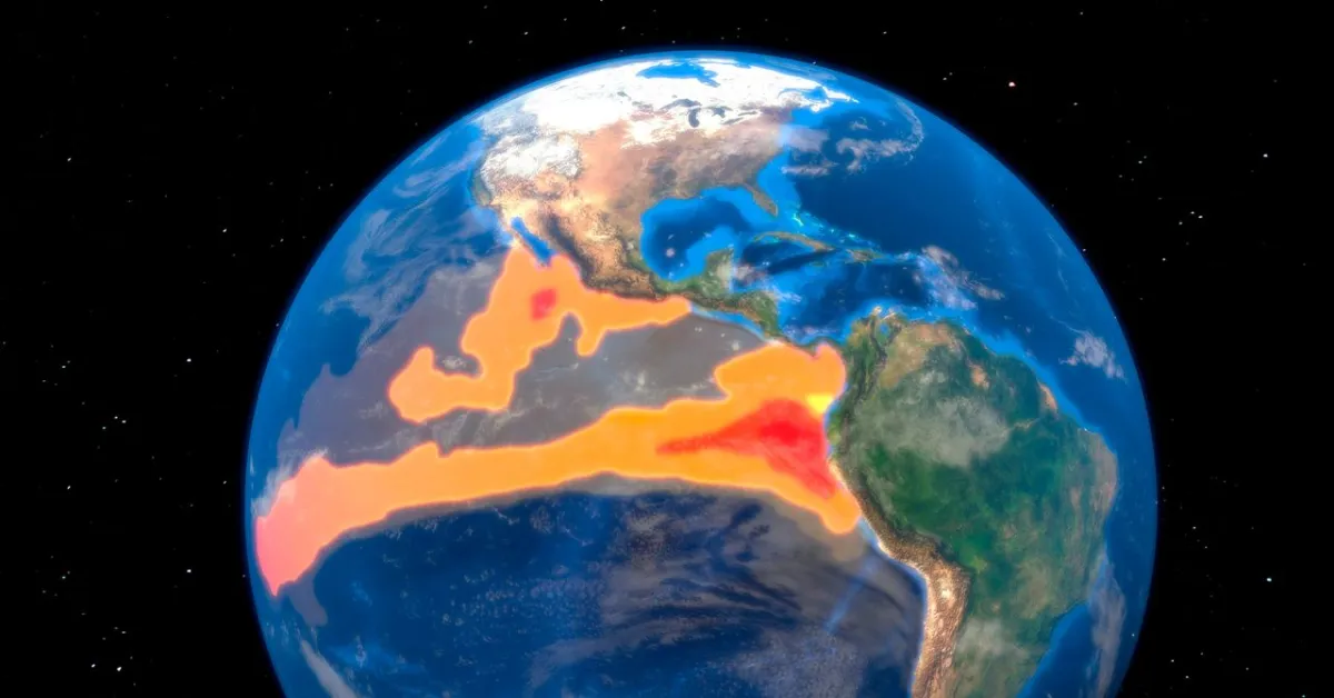
Get ready, because the El Niño we're currently seeing is shaping up to be one of the most intense ever recorded. This recurring climate pattern, marked by warmer-than-usual sea surface temperatures in the equatorial Pacific, is triggering a global weather domino effect that's got scientists on high alert. Released heat from the ocean is set to mess with rainfall, temperatures, and even hurricane activity worldwide.
This year's El Niño has surged in strength remarkably fast and is poised to shake things up, impacting everything from fisheries to ski resorts. While not all effects are negative – think a potential boost in winter precipitation for the parched Southwest – understanding these shifts is crucial for preparedness.
So, what exactly is El Niño? It's officially declared when the sea surface temperature in a specific patch of the eastern-central tropical Pacific, known as the Niño 3.4 region, stays at least 0.5 degrees Celsius (0.9 degrees Fahrenheit) above normal for three consecutive three-month periods. This warmer water disrupts normal weather patterns, often leading to weakened trade winds and a buildup of seawater on the eastern side of the Pacific. Historically strong El Niños, like those in 1997 and 2015, saw sea levels rise significantly, heralding widespread weather changes.
While not an official scientific term, "Super El Niño" is used to describe events where temperatures spike at least 2 degrees Celsius above average. Four events have earned this unofficial title: 1982–83, 1997–98, 2015–16, and the current 2023–24 event. These supercharged El Niños have brought extreme weather, from record-breaking floods in the US in 1982–83 to devastating droughts impacting millions in southern Africa during the 2023-24 event.
Current forecasts suggest a greater than 90 percent chance of this El Niño becoming "very strong" through winter. Projections indicate temperatures in the Niño 3.4 region could soar 3.6 degrees Celsius above normal, potentially surpassing the previous record set in 2015–16. This event is also developing at an unprecedented speed, emerging from conditions closer to its cooler counterpart, La Niña. The economic fallout from El Niño is also significant, with the 1997–98 event estimated to have caused trillions of dollars in losses globally.
The opposite of El Niño is La Niña, characterized by cooler Pacific waters and generally opposite weather impacts. However, with El Niño expected to dominate through at least spring, its influence will be the primary concern for weather watchers and planners.